
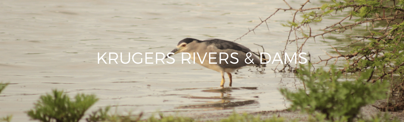
Rivers Systems, Dams and flooding in the Kruger National Park .
Kruger National Park is home to several river systems that play an important role in the park’s ecosystem. These rivers provide water for the park’s wildlife, which includes the Big 5 (lion, elephant, leopard, buffalo, and rhino) as well as many other species. Here are some of the main river systems in Kruger National Park:
- Sabie River: The Sabie River is one of the largest and most important rivers in Kruger National Park. It flows through the southern part of the park and is home to a diverse range of wildlife, including hippos, crocodiles, and many species of birds. Visitors to the park can explore the Sabie River on guided game drives, bush walks, and river safaris.
- Olifants River: The Olifants River is another important river system in Kruger National Park. It flows through the central and northern parts of the park and is home to a variety of wildlife, including elephants, buffalos, and crocodiles. Visitors can explore the Olifants River on guided game drives, bush walks, and river safaris.
- Letaba River: The Letaba River flows through the central part of Kruger National Park and is home to a variety of wildlife, including hippos, crocodiles, and many species of birds. Visitors to the park can explore the Letaba River on guided game drives, bush walks, and river safaris.
- Limpopo River: The Limpopo River forms the northern boundary of Kruger National Park and is one of the largest rivers in southern Africa. It is home to a variety of wildlife, including crocodiles, hippos, and many species of birds. Visitors to the park can explore the Limpopo River on guided game drives and river safaris.
Overall, the river systems in Kruger National Park play a vital role in the park’s ecosystem, providing water for the wildlife and supporting a diverse range of plant and animal species. Visitors to the park can explore these rivers on guided game drives, bush walks, and river safaris, providing an opportunity to experience the beauty and diversity of the park’s wildlife and landscapes.
Flooding in the Kruger National Park
Kruger National Park is located in an area that is prone to seasonal flooding, particularly during the summer months from November to April. The park’s rivers, which include the Sabie, Olifants, and Letaba rivers, can swell to several times their normal size during periods of heavy rainfall, causing flooding in parts of the park.
The history of flooding in Kruger National Park dates back to its early days. In the early 1900s, floods were common in the park, particularly in the low-lying areas along the Sabie River. These floods could be devastating, causing damage to roads, bridges, and other infrastructure, and endangering the lives of both humans and wildlife.
Over the years, the park authorities have implemented various measures to mitigate the impact of flooding in Kruger National Park. These measures include building higher bridges, constructing causeways and dams, and relocating some of the park’s infrastructure to higher ground. In addition, the park authorities have established a flood warning system that alerts visitors to potential flooding in the park.
Despite these measures, flooding remains a risk in Kruger National Park, particularly during the summer months. The park authorities continue to monitor the rivers and weather patterns in the park and take steps to protect visitors and wildlife from the impact of flooding.
In recent years, the park has also recognized the importance of flooding in the park’s ecosystem. Flooding helps to replenish the park’s water sources and provides important habitat for a variety of plant and animal species. As a result, the park authorities have implemented measures to allow for controlled flooding in some areas of the park, to support the park’s biodiversity and ecosystem.
Overall, the history of flooding in Kruger National Park highlights the challenges of managing a protected area in an area prone to natural disasters. However, it also demonstrates the park’s commitment to protecting both its visitors and wildlife, and to preserving the natural environment of the park for future generations.
The Longest river to run through the Kruger Park
The longest river that runs through Kruger National Park is the Limpopo River. The Limpopo River forms the northern boundary of the park and runs for approximately 1,600 kilometers (994 miles) from its source in South Africa to its mouth in the Indian Ocean in Mozambique. In Kruger National Park, the Limpopo River is home to a variety of wildlife, including crocodiles, hippos, and many species of birds. Visitors to the park can explore the Limpopo River on guided game drives and river safaris, providing an opportunity to experience the beauty and diversity of this important river system.
Man made dams in the Kruger National Park
There are a total of 25 dams in Kruger National Park. These dams were built by the park authorities to provide water for wildlife and to control flooding in some areas of the park. Some of the most well-known dams in the park include the:
- Lake Panic
- Transport Dam
- Sunset Dam
- Sweni Hide Dam
- Pioneer Dam
These dams provide important habitat for a variety of bird and animal species, and are popular spots for wildlife viewing by visitors to the park. Visitors can observe animals such as hippos, crocodiles, and a variety of bird species around these dams, especially during the dry season when water sources are limited in other parts of the park.
There are approximately 300 artificial water points in Kruger National Park. These water points were created by the park authorities to provide water for wildlife, particularly during the dry season when natural water sources can be scarce. The water points are typically supplied by boreholes or by diverting water from rivers or streams into small dams or pans.
The provision of artificial water points is a contentious issue in some conservation circles, as some argue that they can disrupt natural ecological processes and concentrate wildlife in certain areas, which can lead to overgrazing and other environmental impacts. However, the park authorities argue that the water points are necessary for the survival of wildlife during times of drought and that they are managed in a way that minimizes any negative impacts on the environment.
The park authorities also monitor the use of the water points and adjust their management strategies as necessary. For example, in some areas, the park has implemented rotational grazing programs to prevent overgrazing around water points, and in other areas, the park has reduced the number of water points to encourage more natural patterns of movement by wildlife.
Overall, the provision and management of artificial water points is an ongoing challenge for the park authorities in Kruger National Park, as they strive to balance the needs of wildlife with the conservation of the park’s natural environment.
Fish species in the Kruger National Park
Kruger National Park is not known for its fish populations, as the park’s rivers and waterways are often too shallow and fast-moving to support large numbers of fish. However, there are a few species of fish that can be found in some of the park’s water sources. These include:
- Catfish – There are several species of catfish that can be found in the park’s rivers and dams, including the Sharptooth Catfish and the Vundu.
- Tilapia – Several species of tilapia are found in the park’s rivers and dams, including the Banded Tilapia and the Mozambique Tilapia.
- Yellowfish – The Largescale Yellowfish and the Smallscale Yellowfish can be found in the larger rivers and dams in the park.
- Mudfish – The Lungfish and the Gilled African Mudfish are also found in some of the park’s water sources.
While fishing is not permitted in Kruger National Park, these fish species play an important role in the park’s ecosystem, providing food for predators such as crocodiles, otters, and fish eagles. Visitors to the park can observe these fish species in their natural habitats, either by taking guided river safaris or by simply observing the fish from the banks of the rivers and dams.